ORBiDANSe:
Orbital Big Data Analytics Service
Launched in December 2019, ESA OPS-SAT
is a next-generation cubesat carrying an experimental computer ten times more powerful than on any current ESA spacecraft.
Its designed for paving the way into future satellite technology offering an experimental platform.
ORBiDANSE is one of these experiments. It pursues a very specific goal: making the satellite a datacube engine on freshly acquired data. To this end, the de facto datacube gold standard engine, rasdaman, has been ported to this platform and now is on board enabling ad-hoc queries on imagery acquired.
Hence, ORBiDANSE will pave the way for on-board ad-hoc processing and filtering on Big EO Data by (i) porting an existing successful engine to a Cubesat and (ii) optimizing this orbital data service by minimizing its resource footprint.
Goal is to achieve a quantum leap in both EO service quality and Big Data Analytics performance.

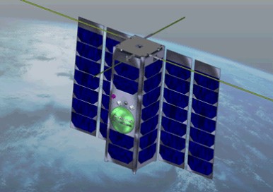
Figure: OPS-SAT in an artist's view (ESA)
This project is driving the "ship code to data" paradigm to the extreme: it makes a Cubesat an online Web data service for real time EO acquisition, processing, and retrieval, based on the ISO Array SQL standard adopted in 2019, which effectively is rasdaman's query language. Images get acquired by the on-board camera and geo-referenced via GPS. Access is done via a high-level array query language allowing ad-hoc processing and filtering on spatio-temporal raster data, similar to what standard SQL accomplishes on tuple sets.
On board, such queries are evaluated by the rasdaman Big Array Data Analytics engine. Among others, it supports spatio-temporal queries, hence is truly multi-dimensional. The configuration can be updated/reconfigured in-flight, although emphasis will be put on automatic optimization, including acquisition planning based on incoming queries. In a direct scenario, targeted subsetting/pocessing of imagery can be downlinked directly to the requesting client, effectively turning the satellite into an image database. In a federated scenario, a client may submit some complex decision support query to a data center; the rasdaman instance there finds out that data are missing and spawns a sub-request to the Cubesat; merges its locally computed results with the Cubesat response into the final result sent back to the user. As rasdaman is already cloud-parallelized, queries can be distributed automatically between ground and space instances.
This project has been partly funded by German Ministry for Digital and Tranport (BMDV).
|

